
- New Rare Art
- Artist
- Andy Warhol (16)
- Banksy (85)
- Beejoir (8)
- Billy Childish (9)
- Damien Hirst (17)
- David Hockney (9)
- David Shepherd (8)
- Death Nyc (30)
- Emek (8)
- Jean-michel Basquiat (8)
- Jj Adams (16)
- Kaws (15)
- Keith Haring (9)
- Mike Shenton (12)
- Mr. Brainwash (18)
- Pure Evil (24)
- Shag (josh Agle) (9)
- Shepard Fairey (34)
- Stik (11)
- Tracey Emin (17)
- Other (1893)
- Character
- Era
- Franchise
- Theme
- Type
Original 1839 Antique Pre-Civil War US United States America USA Rare Tanner Map
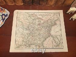
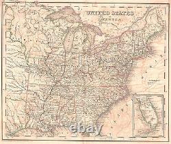
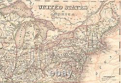
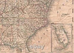
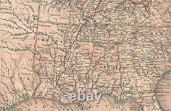
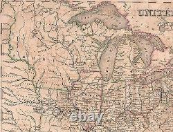



Fine and Rare Adornment of American History. Impressive on any Home or Office Wall. 1839 Pre-Civil War Tanner Map of The United States Less than 1,000 Estimated to Remain. Map is in Very Good/Good Condition.
Two short closed separations along the top and bottom of the fold indentation previously repaired. Original Map Drawn by Henry S.
Tanner and Engraved by J. Yeager for the 1839 Edition of the Encyclopaedia of Geography: Comprising a Complete Description of the Earth, Physical, Statistical, Civil and Political; Natural History of Each Country, and Physical Structure of All Nations; by Hugh Murray; Illustrated with Eighty-Two Maps, and Eleven-Hundred Engravings on Wood, Together with a New Map of the United States; Revised, with Additions, by Thomas G.
Bradford; Published 1839 by Lea and Blanchard: Philadelphia, 1839; a copy of the Title Page of which is Included. A Fine Rare Map for the Collector, or Makes More than a Special Imaginative & Creative Gift. Visit my Store to view More of my Collection. Thank you for your interest. Impressive On Any Home or Office Wall Dimensions: 10" x 12.25" Fine Adornment of American History A Fine and Rare Map for the Collector, or Makes.
Than a Special Creative Gift. A Frame is Not Included. The Framed Map pictured is Featured to show the Beauty of the Maps when Framed. Greetings from Historical Savannah, Georgia: Founded 1733. Some, to beautify their parlors, chambers, and libraries...
Loveth, getteth, & useth maps, charts, and geographical globes. John Dee, Advisor to Queen Elizabeth I.
This item is in the category "Antiques\Maps, Atlases & Globes\North America Maps". The seller is "jonesjackson" and is located in this country: US.This item can be shipped worldwide.
- Maker: Tanner
- Format: Engraved
- Published: 1839
- Subject: Military & War
- Topic: United States
- Printing Technique: Copper Plate
- Year: 1839
- US State: AL, FL, GA, MS, NC, SC, Alabama, Connecticut, CT, MA, ME, NH, RI, VT, DC, DE, MD, NJ, NY, PA, Delaware, Florida, Georgia, IL, IN, MI, OH, WI, Indiana, Kentucky, Louisiana, Maine, Maryland, Massachusetts, Mississippi, New Hampshire, New Jersey, New York, North Carolina, Pennsylvania, Rhode Island, South Carolina, Tennessee, VA, WV, KY, TN, Vermont, Virginia, Texas
- Publication Year: 1839
- City: New York
- Country/Region: United States of America
- Engraver: J. Yeager
- Cartographer/Publisher: Tanner
- Date Range: 1800-1899
- Type: Hand-Colored
- Original/Reproduction: Antique Original

